
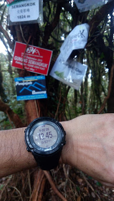
Welcome to Gunung Semangkuk
Gunung Semangkuk located in Fraser Hill, Pahang with an
altitude of 1824 meter. Journey of conquering Gunung Semangkuk (or ‘Semangko’) will
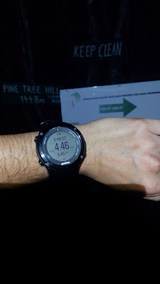
start from Pine Tree Hill and Twin Peak. We can say that every hikers who succeeded climbing Gunung
Semangkuk are often reward themselves with pride as they also conquered two more mountains i.e Pine Tree Hill and
Twin Peak at one go.
You may park your car along narrow road of The Pine Tree Hill arch or further up a bit there's a very small area for carpark, but do note to park your car properly and do not block any entrance.
You may park your car along narrow road of The Pine Tree Hill arch or further up a bit there's a very small area for carpark, but do note to park your car properly and do not block any entrance.
Though the altitude of Gunung Semangkok is 1,824 meter, the
starting point via Pine Tree Hill is already at the height of 1,320 meter. As such, we just need to climb another 500 meter elevation only,
that will at least lift our spirit up.

taken from my Suunto Movescount
The distance may vary according to existing record, blog and maps taken from the internet which within the range from 11km to 15km one way. In my case, the distance is 12.45km (suunto ambit 2) one
way, that makes almost 25km return. You may find the gpx route here : suunto movescount gpx file (view as mapbox, then copy route).
Though my distance recorded 12.45km one way, when I export the track to routeplanner, the distance became 12km, short of 450 meter. What is 450 meter means to us? Almost a half kilometer climbing which will took hours to complete and add up to the total duration time. 450 meter is equal to 10 km for me...arrgh..!


See? 12.45km....distance
Though my distance recorded 12.45km one way, when I export the track to routeplanner, the distance became 12km, short of 450 meter. What is 450 meter means to us? Almost a half kilometer climbing which will took hours to complete and add up to the total duration time. 450 meter is equal to 10 km for me...arrgh..!

Upper left - 12km instead of 12.45km...huhu
Each of the flag represent the mark. From right - Twin peak, water point, sungai merah, and Semangkuk Peak (what is missing here is the Helipad... unaware that I had passed this section...demmit!).
Searching thru suunto movescount, there were few Gunung
Semangkuk map readily available and I need to go pass through Pine Tree, Twin Peak, Water point, Sungai Merah, Helipad and
finally Semangkuk Peak.
However, there was no distance or location from Twin Peak to
Water Point, Water Point to Sungai Merah and so on. It was quite difficult for me to measure the time taken and
elevation – thus editing the map in suunto movescount for Water point, Sungai Merah and Helipad were just based
on estimation.
I would advised using GPS navigation device which will
assist you in estimating the remaining distance and Navigate using the correct path preventing from getting
lost. My suunto ambit 2, pre-loaded with Gunung Semangkuk route
proven to be successful.
Starting Point Gps coordinate : 3.711805, 101.727518
Starting Point Gps coordinate : 3.711805, 101.727518
- Started from Pine Tree trail head at 3.00am towards Pine Tree peak seems easy. Dry Trail
- From Pine Tree Hill to Twin Peak, short distance only, piece of cake.
- Twin Peak to Water point – mostly downhill, a little bit technical but manageable
- Water Point to Sungai Merah – moderate, starting to get tired
- Sungai Merah to Helipad – hard! Its a long and high altitude climbing
- Helipad to Semangkuk Peak – Hard! Endless twist and turn
In summary, distance from Start to Peak – 12.45km. Time
Taken – 9 hours :

Gear Used : no specific gear, except good trail shoes –
Adidas hydroterra Shandal
Head Lamp – Fenix, blinkers and
additional light with extra battery
Navigation : Suunto Ambit 2
Food : apple,
chocolate bar, buns, gardenia toastem
Drinks : plain water
2 liter, Ribena 500ml, coke 500ml (refill at Sungai Merah campsite, using sawyer water filter).
Advice for Daypack
- Need to be physically and mentally fit for this climb. First, you need to overcome fear walking at night (starting and ending). The distance is 12km one way is not an easy climb.
- Bring basic hiking gear though you may not use it but essential to have – ground & fly sheet, rain jacket, first aid kit, lighter, power bank, extra battery, water filter, glove.
- Bring food for extra one day – just in case
Caution
1) Poisonous creatures – snakes, scorpion, centipede (No snake but but the other two were present)
2) Sting creatures – bee, ants (there were hiker get stung by bee)
3) Nature’s wrath – heavy rain, slippery trail, loose
grounds, lightning (it was raining in the evening)
4) Flora of torture – thorny and tiny leaves that hooked (my cap torn by these)
5) Creepy Sounds – nocturnal beings (gives you the jitters, but just ignore them)
Trail Matters
Hikers may get confused on the trail especially from Helipad
to Semangkuk Peak. It seems that after helipad, the trail will make you to go
down, but you may think that it could not possibly be because the trail is
supposed to be only upward from Sungai Merah to Peak. Don’t worry, just follow
the ribbons/marker on the trees.
Hikers may also feel that they have been following the same
sections, trails and making unnecessary U-turn as they all are look-alike & seems that you have been there before but it is just a delusions from a tiring
mind and body. Believe me, the trail is correct.


Around 1.30pm or so, it rain heavily. I couldn't take photo at helipad and sungai merah on the way down. What a big disappointment!


Pine Tree Hill. Yay! Easy...

Twin Peak...piece of cake.
Almost sunrise...but the view blocked by fog.
Can someone change the signboard with a proper one?

This is the water point...1.55km from Twin Peak.
I think the water source is nearby.
Please turn left for Gunung Semangkuk ya.

There you go. 6.81km from Start, we have been walking, climbing for 4.51 hours and the time was 7.48am

The direction to Gunung Semangkuk is properly assigned.
Kem Sungai Merah is next

Kem Sungai Merah. 8.66km from start. 5.38 hours.

The surrounding.
Sungai Merah is an ample space campsite. Most hikers will overnight here and making their way up the next morning.

The water source i.e small river is located behind the tree with signboard. We can hear the stream flowing.

Refill your water here. 30 meter from the campsite signboard. The water is refreshing!

This is the remaining distance that we have to endure before reaching the peak, between Sungai Merah and Semangkuk Peak. It showed 1.95km to go.

Responsible hiker. I found this yellowish rope on the track. I tight it to this tree for the benefit of other hiker.

after hours of hike, it was only 176 meters distance remaining to the peak.
Please focus on the triangle thingy on the watch, its a direction you need to follow, well mostly it is correct.

Yay! made it! After 9 grueling hours, 12.45km.

If it wasn't for you, the red tree sticker, I may have lost confidence

same photo again at the peak.
same cap, same tshirt, same tights, same shoes from other hike.
Around 1.30pm or so, it rain heavily. I couldn't take photo at helipad and sungai merah on the way down. What a big disappointment!

The rain stopped. Water point on the way back

Twin Peak again. at 5.06pm, its getting dark

Finally, we reach the starting point and ended the extreme hike in 16.5 hours.
There you go, Climbing Gunung Semangkuk Daypack. It's tough, hard and tiring. So, just be prepared.
Salam tuan Ijam,
ReplyDeleteFYI I manage to complete Rajah KKB based on info from this blog, so thanks a lot for your excellent & informative blog
My question is how do you rate this Semangkuk hike compared to Rajah KKB cos i noticed u have take longer time to reach the peak though the elevation gain is lesser
Thanks
walaikum salam, first of all thank you for reading and glad it had benefit the reader.
ReplyDeleteFirst of all Semangkuk is technical from the start where you need to descent flight of stairs, need to climb pine tree, twin peak then ascend to semangkuk.
After Sg Merah, the trail get really hard as it took me hours before I can reach the top. But during descend, it's a kacang putih, sekejap dah sampai sungai merah. On that day of climb, I went with my hiking buddies who were quite slow then unable to continue upon reaching twin peak. Around 1 hour plus wasted in terms of waiting. Then from last water point back to twin peak was another nightmare with endless ascending. Nevertheless, the journey was an unforgettable one.
For Rajah via KKB, the start was very straight forward, you may run as the trail was flat. However, it's get more technical further up especially after the last water point.
Both trail had their ups and downs, sometimes it's difficult to measure the difficulty as it depends on one's strength and your team member capability. I would recommend 4 hikers at one time and the least is two.
OK tuan, thanks for ur insight. I guess both Rajah KKB and Semangkuk are comparable in term of toughness....plan to hike Semangkuk one day, i'llah
ReplyDeleteBtw, is it u that i've bumped into on the way to Apek waterfall last 2 weeks? If yes, nice to meet u....:)
Yes, it was probably me...hehe
ReplyDeleteTuan ada GPX files?
ReplyDeleteAda tuan. Bagi email address. Saya email
Deleteplease email it to me kyosunangi@gmail.com
DeleteHello Hikers,
ReplyDeleteVery informative information. Thanks for your good share where this will sure helps my team for our preparations... Plan to hike on May'17
Once again thank you and please keep continue your good support...
God bless you...
hi Mr Sritharan, glad you like it. Hoping to write more experience after this. Good luck on your journey. be safe ya
Deleteboleh tak ws saya, ada byk nak tnya ni 017 3675473 - alep
ReplyDeletealamak bro, saya baru baca comment ni, boleh je whatsapp saya, 0129108244
ReplyDeleteThanks Ijam. Your blogs are very informative, I have been reading them often. It will be a great help for my day hike this coming Friday.
ReplyDeleteGlad i could help. By the way, Semangkuk using Waterfall Jeriau is nearer. Can save a lot of elevation and distance...hehe
DeleteHi Ijam, I have done it yay!!! Gruelling 19hrs. Thks for ur advise but I figured tis is my first time so I chose the full course la. Could have been much faster but it's a team hike. Anyway I hate myself for doing it. The experience was brutal, energy sapping and returned bk in heavy downpour. There was no signage at Helipad, luckily I have read it frm other blog abt tis so I recognised it but no so lucky for other members who totally missed it and was searching for it. Anyway, thks for ur kind advise.
ReplyDeleteWah! That's was fast man...! Congratulations on conquering semangkuk. Come back again next year.
DeleteWow menarik betul perkongsian u on Semangkuk..in 2016 😅..my friend and i baru nak reki reki. i dah sampai pine trail aje,yup i heard nak ke twin peak kacang ajr dari situ,but to reach Semangkuk bunyi nya scary takut cannot make it back within a day..ramai ke hikers yang bermalam utk completekan trail ini..tq for sharing tuan
ReplyDeleteAha...dah boleh dah tu. Tapi my advice u try sampai kem sg merah dan evaluate energy ada tak lagi masa ni, sbb lepas tu mencanak kaw²! Ramai yg menjadikan sg merah ni camping ground. Set khemah kat sini, hentak peak semangkuk. Esoknya balik, lega sikit bunyinya
Delete