Sunday, January 27, 2019

Bukit Baginda - Negeri Sembilan


Bukit Baginda located in Negeri Sembilan with a height of 450 meters. It is popular with its rock formation called "wave rock".

Summary of Hike
Total distance - 4.23 km (2.13km one way)
Estimated hiking duration - 1 hour 15 minutes ascending (less than one hour to get down)

Trailhead Coordinate

2.865633, 102.226148


Map screenshot if you are still need to reconfirm on the location

Parking
Ample parking space provided at the roadside or at the designated area.

 Parking at the roadside also can

 The designated parking area is up ahead


Entrance Fee
RM8 per person

The fee rate


The entrance - just go straight - after registration

The Trail Condition 
Its wide and open. Trail markers are placed at intersections.
You will walk through rubber plantation and going uphill.


There are total of 8 check points known as CP. I'm not going to get into details for a trail with 2 km in distance. The check point are very close to each other at an estimation of few hundreds meters apart.


CP 1 is located 1km from start. This is where the climbing start. If you need a cold ice drink and fruits, you can get it here as there is a stall operated.


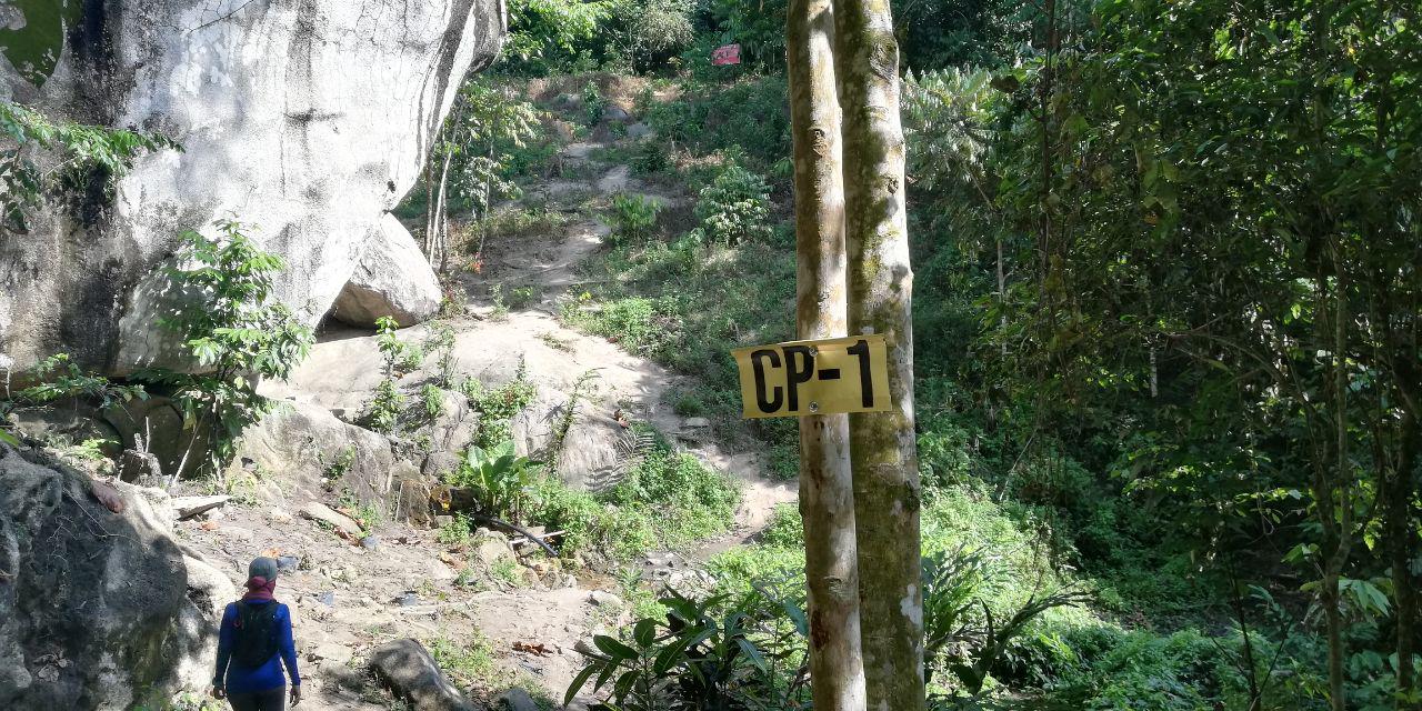
CP 1 also have one giant rock that you can climb and make an ideal photo on brag in social media.


Missing here is CP 5 - might have missed it...dem...


Yes, made it to the peak. 2.13km in 1 hour 15 minutes.

The wave rock is less than 100 meters more.

 Keep calm and hug a tree


This is the wave rock that others talk about..
Mission accomplished.

4.23km in 2 hours 11 minutes of total journey...piece of cake


Bukit Senaling - Negeri Sembilan


Bukit Senaling located 146km from the heart of Kuala Lumpur, estimated 2 hours journey.
Bukit Senaling is gaining popularity few years back with its astonishing view at the top overlooking valleys and mountains.
At 394 meters in height and 3km in distance (one way) it is suitable for beginner level.

Summary of Hike
Distance - 6 km (3km one way)
Estimated hike duration - 50 minutes to 1 hour (moderate pace)
Bring enough drink water ya, 1 or 2 litres should be sufficient.


This is the junction from the main road, if you come from Kuala Pilah, you need to turn right.

The junction from google map


Car Park

Ample Car park.

from the car park, just walk on the tarmac around 100 meters you will reach the registration counter.


Trailhead Coordinate

2.690524, 102.264378  - The coordinate taken from google map.


The trail head not far from the parking area


from the car park, just walk up, the registration counter is there.

Registration Fee
Every hikers need to register at the starting point. The fee is RM15 per person.


Now Lets Climb.

The trail is clear and wide. It will take you through palm oil plantation all the way up.
Adequate signboard at every intersection, no worries of getting lost.


Only a quarter of the journey if you reach here

The trail mostly like this - like a dessert

Another part of the hike. You are getting nearer

Its an open trail. Hikers will exposed to direct sun. Be prepared with sunblock and covered clothes

This is on our way down, be careful ya

Sturdy stairs made from tree branches

View at the Top : 


nice ey? Can you spot the peak with the flag on the left? 

 Made it in 49 minutes, 3km in distance

 When the weather is right, you can view a sea of cloud here

Like this..- photo from google image


No doubt with these spectacular view at the top, every hikers will spend a lot of time taking photos at every single corner they could find.


Back at parking. 6.25km in total distance

It was an easy hike - it can be completed within 2 hours including taking photos..hehe.
May I recommend hiking Bukit Baginda after hiking bukit senaling.....its just 40km away...lets go...