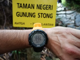
Gunung Stong with the height of 1422 meters located in the
state of Kelantan - 5 hours drive from Kuala Lumpur. There are 2 routes to choose from i.e route 1 – from car
park straight to Gunung Stong peak (shorter route) while route 2 – car park to Gunung Ayam –
Gunung Baha – Gunung Stong (longer a bit).
The entrance of Gunung Stong
from left to right...2 routes separated
Our plan is to hike route 2, however, due to
miscommunication with the guide, we only realize that we were following route 1
all along….sigh…
The guide fee, registration etc is around RM350 per guide
and the guide can bring a maximum of 12 person.
We started at around 8.30am or so and successfully made it
to Stong Peak around 12.53pm in almost 5 hours. Descending was an easy part
which only took us about 2 hours 30 minutes to 3 hours.
The details on the distance and time are as follows :
Car Park to Kem Baha Junction
Distance from start : 1.1km
Duration : appx 45 – 50 minutes
Time of the day : 9.15am
Trail difficulty : moderate inclination
Kem Baha junction - going straight will lead you to Kem Baha and the nice sunset/sunrise.
Going on your right - will make you climb towards the Gunung Stong peak
Standing at the junction - take left to Kem Baha, right to the peak
Kem Baha Junction to Kem Baha
Distance : 320 meters
Distance from Start : 1.48km
Duration from Kem Baha Junction: 5 minutes
Duration from Start : 58 minutes
Time of the day : 9.22am
Trail difficulty : moderate inclination
Kem Baha to Sungai Rantai
Distance : 610 meters
Duration from Kem Baha junction to Sungai Rantai : 24
minutes
Distance from Start : 2.44km
Duration from Start : 24 minutes
Time of the day : 10.06am
Trail difficulty : easy
From Sungai Rantai to Permatang Bonsai
Distance : 3 km
Duration from Sg Rantai to Permatang Bonsai : 24 minutes
Duration from Start to Permatang Bonsai : 2 hours 6 minutes
Distance from start : 5.5km
Duration from Start : 3 hours 49 minutes
Time of the day : 12.12pm
From Permatang Bonsai to Gunung Stong Peak
Distance : 680 meters
Duration from Permatang Bonsai to Gunung Stong Peak : 36
minutes
Distance from start : 6.18km
Duration from Start : 4 hours 29 minutes
Time of the day : 12.53pm
I would advise for those who are planning to do Gunung Stong route number two daypack, it is possible actually - please park your car outside the gate - just in case you unable to make it before the gate close at around 5pm - 7pm.
Back at Kem Baha Junction
Clear sky from Kem Baha at 3pm something
Finally, we reached the hut just in time
Done ! 12.12km in 7hours 36 minutes, time 4.40pm
This is gua 'keris' - dont leave dabong without visiting this keris like structure.
Our Gunung Stong Guide charge us RM50 per head for this. Its worth it!
He will explain the stalactite, stalagmite - rock formation, the cave was once inundated by sea water - sea weed formation on the rocks, unique spider species, sparkling white rocks, and many more.
In the background is the Dabong small town pasar malam (night market) on Saturday evening.
Please go while it is still bright around 6pm - it closes soon....


