Location
Behrang, perak. 1 hour drive from Kuala Lumpur
Organizer
Ajul Adventure empire
The organizer had made my hardcore hike dream came true. I mean, they provide the platform
What is Trans Slim
Trans Slim is where your hike start at one point and end at the other.
And this trans slim started at Water Treatment Sungai Geliting, Perak and will end at Water treatment plant in Sungai Dara (vice versae)
Permit, Guide and 4 wheel Truck
Permit is required. 4 wheel also required to ferry us from Sungai Dara to Geliting Water treatment Plant. We parked our car at Sungai Dara.
Our hike lead by 1 guide (in front) and 2 sweeper (last man standing).
Why I want to Hike Trans Slim so Bad?
Trans Slim is in my "to do list" and wanted to do it somehow or someday.
Famous for its long and hardcore trail, I wanted to experience it myself.
I've registered the hike during covid but the trip was cancelled last minute.
Now i've completed the course, a sinful regret when you were in the middle of the trail but the regret soon faded away once you conquered all the mountains and when you make your final step at the parking lot. Believe me, its true.
Challenges
- Not easy to keep up with the youngsters
- They have lean, tall body and enormous amount of energy that can stand such endurance
- whereas, me almost half a decade, this old body have to work extra just to maintain the pace which frequently i choose behind the pack
There are 4 major peaks to conquer i.e
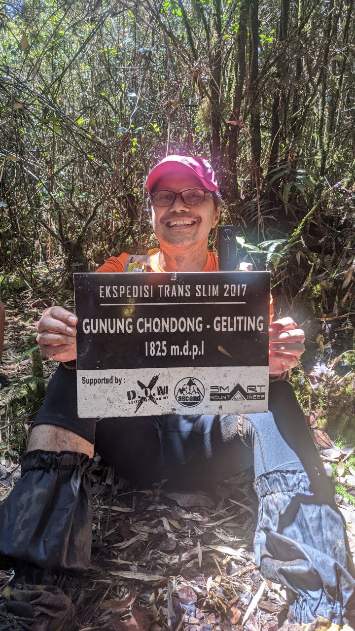
Chondong Geliting at 1825 meters
Tumang Batak at 2082 meters
And Gunung Liang West and east at 1933 meters
Total Trail Distance and duration
Total distance is around 32km
Duration - for compress hike like us - I ended up with 31 hours 30 minutes.
Breakdown Pit Stops and distance
Watch out! The distance may be misleading as my suunto 5 on that day seems giving doubtful distance.
The correct measurement would range from 32km to 36km but mine was 45km in total which to me rather ridiculous.
Readers should download gpx file from wikiloc as this what i did to assist me in the navigation.
Uncharted Trail
The trails were left untouched for quite some time due to covid19 movement control order (MCO). With hikers rarely used this trails making it more dense and trails that previously clear became unclear, covered and confusing.

Waiting for the pick up truck
1) from Start (geliting water treatment plant) to Camp Sungai Durian
Distance : 7.5km
Time Taken : 3 hours 30 minutes
Trail condition : river crossing
Trail Difficulty : Easy, mild ascending mode

Easy part...my knee hurts but don't be such a "p**sy", man...
Tragedy at the River
At the beginning of the hike, we need to cross a river (sungai Durian), a waist deep and nothing to play with. During the crossing, we need to get down to the river bed and make our way up to the rock (some of the hikers jumped without hassle), but me, I'm not that confident enough to jump on the slippery rocks. I asked one of the hiker to hold on to my stick (camera stick) but somehow slipped and swept away by the strong current. I tried to pull up but the fierce current dragged my with it. There we were, 2 of us, holding on for our dear life. Luckily we able to stand up and position ourselves away from the strong current. Soaking wet all over, my handphone was tucked in my waist belt (still ok after the drowning but camera got moist). The situation that we were in at that moment was how to get on top of the big rock. Then, help came. 2 of the team member pulled us up, I prayed to god that we do not slip again though its still slippery during the hoisting and pulling.
During that emergency situation, my knee snapped, "pop!" like a twist and it hurt like crazy. But pain is secondary, survival is our main priority. I dont feel the pain until I was saved and able to stand on the ground. My left knee was too weak like my leg going to break into 2 parts when i hoist my body up the slope. A wrong turn of the leg would mean pain. I cannot jump and landing on the left foot afraid my bone will break. The distance was few kilometers from start and we have some 20km mountain to go. Imagine that.
Snake Encounter
There was a time the front pack (I was at the back...yes, slow pace) unrealized their footstep somehow had disturbed a relaxing snake. I noticed one of the hiker ran toward us saying "ular, ular!" ("snake, snake"!). Later we found out that the snake also perturbed with our presence and ran away. Yes, ran away chasing us like its going to bite you
2) from Camp Sungai Durian to Chondong Geliting
Distance : 7.1km
Distance from start : 14.6km
Duration from Start : 8 hours 22 minutes
Time Taken from camp sg Durian to Chondong Geliting : 5 hours 52 minutes
Trail condition : dry, soft
Trail difficulty : hardcore, climbing all the way

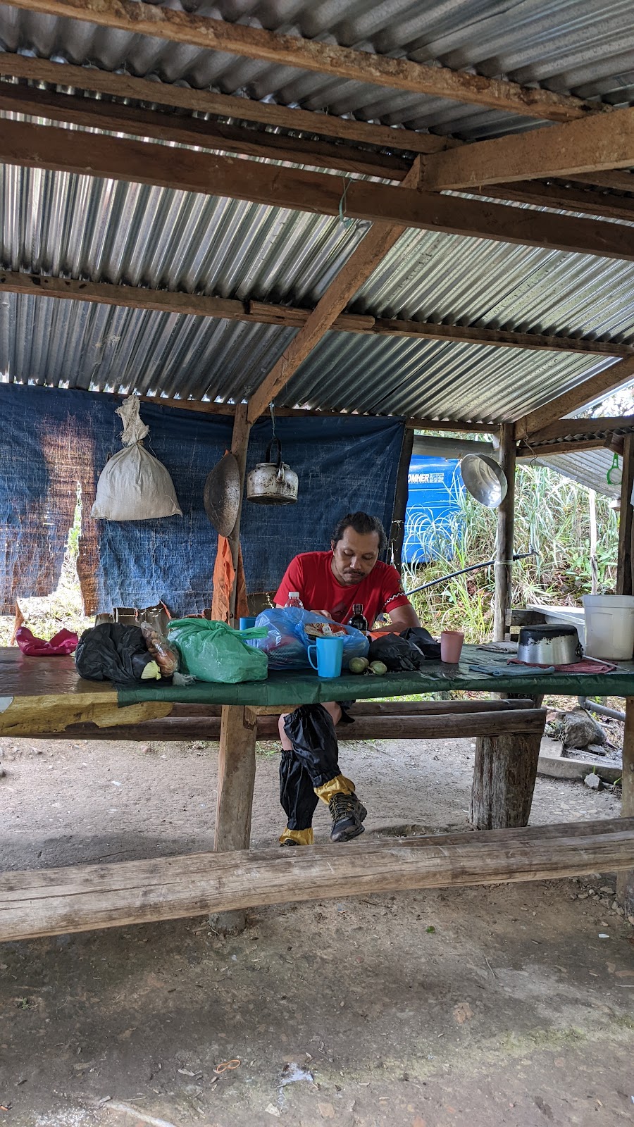
Sungai Durian pit stop for breakfast

My protruding stomach can eat anything right now...the mossy look tasty
My anti-leeach socks perform well on that day but still got bites at the gap

Powerful quartet! Fast hikers

Our hardcore and responsible guide, mr Oli

Mr Hasnan (left) and others
3) from chondong Geliting to Kem Dengkur
Distance : 3.4km
Distance from start : 18km
Time taken from chondong geliting :
Time taken from start : 20 hours 28 minutes
Time reached here : 4.25pm
Trail condition: dry
Trail difficulty : hard

There are 2 water points here. The nearest will be yellowish colour water. The farthest will be crystal clear

At kem Dengkur, the time was at 4.35pm
Blury image as my handphone lens got moisture4) from kem dengkur to Tumang Batak
Distance : 7.5km
Distance from start : 23.5km
Time taken from kem dengkur :
Time Taken from start : 16 hours 17 min
Trail condition : dry, soft, wet
Trail difficulty : hardcore, climbing all the way

At Tumang Batak Peak, 10.24pm.
After 16 hours of climbing
Lost in The Dark
We started hike from kem dengkur scaling to Tumang Batak around 5pm.. it's getting darker and it turns to a pitch black few hours later. Our headlights are our sole guidance to shed light what infront of us.
I can't really recalled the time but maybe some where between 8.00pm, 9.00pm, we reached one area and our guide couldn't find the correct trail. Salute to 3 of them who searched hi and low to enable us to continue. Minutes turned to hours, we just sit on the cold wet ground waiting for our guide and suddenly, mr oli shouted "ok here, here", we just followed the voice where it came. Yes, we managed to proceed and reached the Peak of Tumang Batak at 10.24pm. The hike was really tough. Rested for a while here, having my McDonald leftover fried chicken.
5) from Tumang batak to Kem Pisang (overnight)
Distance : 2km
Distance from start : 25.5km
Time Taken from start : 18 hours 18 minutes
Time taken from Tumang Batak :
Trail condition : dry
Trail difficulty : moderate, downhill

At kem Sungai Pisang, 12.25am
Overnight in a cold, eerie night
Kem Sungai Pisang - A Cold, pitch black night
We reached here around 12.25am after descending from Tumang Batak. Earlier plan for a short rest and a quick water refill turn out to be a long night sleep. The best decision ever made since most of our energy had been extremely exhausted hiking for 18 hours. Few of our fellow hikers do not use emergency blanket while sleeping on the freezing ground. Pity them.
We supposed to wake up around 2.30am, but despite our gogo, oli alerted us to wake up but most of us still in deep sleep. Haha...
Another night another day
We woke up wee hours in the morning and started hike around 6.30pm. Its a brand new day and brand new energy. Wanting to finish the hike as soon as possible keep pushing us forward.
I just can't believed we need to hike further up to Gunung Liang. With my injured knee, i tried to take it slow and scaled gunung liang with my remaining energy.
6) from Kem Sungai Pisang to Liang West & East
Distance : 9.2km
Distance from start : 34.7km
Time Taken from start : 27 hours
Trail condition : dry
Trail difficulty : hardcore, climbing all the way
Gunung Liang East & West
It's hard climb from sungai pisang to Liang West peak. We reached the summit around 9.13am (2 hours plus from sungai pisang). Lisng west peak was full of hikers. Such a famous mountain to hike. We didn't rest long here as we have long way to go.
Reached Liang East around 10 minutes, took photo and off we go.

Peak of Liang West. 9.13am


7) Liang West & East to Finishing point (parking)
Distance : 11.1km
Distance from start : 45.8km
Time Taken from start : 31 hours 30 minutes
Time of the day : 1.37pm
Trail condition : dry
Trail difficulty : hard, steep slope, hang on to something
The ascending from Liang to kem 7E was not easy at all. It has steep slopes, need to hang to something in order to go down, it's getting harder when my knee hurt.
Gunung Liang to 7E
I don't even bother to take photo of time when we reached 7E as we didn't stop at all...haha....continued to next pit stop, Lubuk Hantu...
7E to Lubuk Hantu
Still in descending mode, down and down. Slowed down due to knee injury, if not, i would be running going down. Reached Lubuk Hantu for a quick dip in the river to cool my body down and wash away the sticky sweat. A few moments later, our guide mr oli and one more hiker also reached here. Very fast hikers!
Lubuk Hantu to Finishing point
Around 3 to 4km to finishing line. Its almost flat in descending mode. We couldn't imagine our joy when we reached Sungai Dara dam, a sign that our hike is over. It's another 700 meyers to parking lot walking on the tarmac...we smiled all the way to parking lot, another milestone for my hiking journey and thousands of memories.

Sungai Dara Dam

Completed in 31 hours 30 minutes
But the distance was way too far...my settings was gps-glonass.