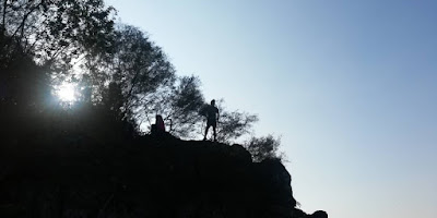
Bukit Batu Chondong located behind zoo negara, at a small town called Kampung Kemensah with the height of 260 meters and distance of 410 meters only, it is one of the easiest hike in Kuala Lumpur. I would recommend hiking Batu Chondong because of the view at the top - mesmerizing!
A glance through on the overall trail
Getting There
Google for Bukit Batu Chondong, it will take you there right on the spot. GPS Coordinate : 3.218221, 101.786373. However, the road is too narrow even if you park at the roadside, it will make the road even narrower and inconvenience to others especially people who lived there.
Parking Area - RM3 per car
The landmark of the entrance is the nearby chicken coop (reban ayam in malay...i think).
There is no trail marker/signboard of the entrance but there will be many hikers flocking the area every weekend. You may ask around for the entrance if you are not sure.
Walking to the starting point from the parking
This is the entrance
Appreciate if you could park your car at Kombat Zone Paintball - 300 meters from the entrance with RM3 parking fee. Just follow the road uphill then you will reach the parking area.
The ascending trail may be a little bit challenging from the beginning till the top, yes, there will be no mercy. However, the hike is short and brief - around 30 to 40 minutes you are at the top already. Piece of cake.
This is one of the "bottle neck" section - need to queue
There are few "death-defying" section where you will be climbing precariously on the rock or tree branches, just be extra careful here ya.
This is the "death defying" section where you have to use the rope and 4 core muscle to go up
At the same section, there is a safer route, just below the tree.
Go down and it will take you to the top
This is the most dangerous part, loose your grip you may break your rib...please, please be careful here.
Actually, I'm not recommending going to the peak via this high risk section, there is another way down on the right, just below the dangerous section where you can go down a little bit, then climb back a little, less risk but safe, everyone will be happy.
400 meters to the top - 20 minutes...easy...
Once you are up there, just explore a little bit more as there are few hidden sections with astonishing view.
Going down is rather easy, as it will be all the way down. In 10 minutes you are back at the starting point. Easy right?...


Bro nk tau dekat kemensah tu ade apa lagi ,contact me ,01113164762
ReplyDeleteKalau hiking spot dan trail ada Bukit paw, pondok repin, bt chondong...
DeletePark moto kene bayar ke and ...masuk free ke ?
DeleteBiasanya kena bayar parking tu, ada yg mintak nanti. Masuk free je, tapi kena apply permit dari jabatan hutan
Delete