Bukit Paw
Distance : 9km plus (return)
Distance to Lake : almost 5km
Trail Difficulty : Easy
Parking
We started at Kampung Kemensah, a placed called "Jinbara" - a river chalet
(GPS coordinate 3.225441, 101.780952)
simplified map. Red arrow - from start to the lake. Yellow arrow - From lake to carpark
Park your car here at Teratak Angah - RM5.
The entrance of trailhead is on the left of the photo, going upward.
The pathway leading up is a mixture of cement-gravel.
Its an open trail and also an ATV, motocross favorite route
Reached 1st junction
2nd junction
still at 2nd junction, go to the right ya
from the 2nd junction
reach 3rd junction
Still at 3rd Junction - please turn according to the arrow
Follow the trail. This is an orchard
Please bring some dog food as a kind gesture to them
Plenty of local tree fruits
This is the shack
I would rather say that this shack is the unofficial peak of Bukit Paw as there is no signage of the peak nor Bukit Paw but the view is very nice here.
You may find this shack location on the map
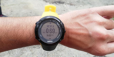
2.26km from start in 43 min to here
Go straight..
From the shack (foreground) just go straight, you will reach this fence. Just cross it.
Continue walking to the trail until you reach a fork junction.
You may find this fence location on the map
This is the fork junction. 2.84km from start. Around 580 meters from the shack
This is the fork junction. The lake is on the right trail.
Taking the left trail will lead you to other part of kemensah i.e kemensah height. It will also lead back to Teratak Angah.
continue on this trail until you reach a junction which is 910 meters from previous junction above.
Please turn left to the lake
I put up a signboard at this junction. Turn left is to the lake. Going straight is the exit.
If you're going to the lake, you need to turn back here to exit.
continue on another 590 meters, you will reach this fork junction.
Left or right is the same destination to the lake. Right path is the shortest.
Reached the lake in 750 meters from the junction
Met few MTB rider here
Lets climb back
Upon reaching back to the junction (to the lake) please turn left to exit. Just follow the trail path until you reach a shallow river.
This is the river. 6.81km from the start
There is also a makeshift hut
Walking further up around 360 meters you will reach this junction. This is important !
Take your right and climb up to exit.
The left trail - I dont know the destination, will explore at a later stage.
we emerged from this bushes. Please turn right following the arrow.
Turning on your left is unknown - yet to explore...
Still at the bushes...7.9km from start
You will notice this signboard on the way back.
Continue until you reach this junction back. The green arrow is where you came from which will lead you to orchard and the shack.
The red arrow is where you are and where you will be headed i.e turn on your left.
Going down
Going down
Chair junction...please go straight
further 350 meters you will reach this junction
Please turn right.
(turning left will lead you to lubuk tedung and Pondok Repin)
Back at Car Park - Total distance 9.08km in 3 hours 30 minutes


Hi, May I know what address to type for waze instead the coordinate? Thank You for the help
ReplyDelete