Gunung Besar Hantu located in Jelebu, Negeri Sembilan
standing 1,462 meters.
The distance is 5.3km (one way) and 10.6km (return) – from the
trail head.
Few notes on the distance as it’s all depending on your
location as follows :
·
From Kampung Chennah Police Station to Kem Bukit
Perjuangan is 4.8km
·
As per current practiced and for my journey, we
parked our car at Kem Bukit Perjuangan for our 4 wheel drive vehicle. From Kem
Bukit Perjuangan to Guard Entrance is 12km
·
From guard entrance to trail head is 1.32km
· From trail head to peak of Gunung Besar Hantu is 5.3km
·
There were other group of hikers who normally
use the roundabout to hop on 4x4 or lorry. It is just less than 400 meters from
Kg Chennah mosque (if I’m not mistaken).
GPS Coordinate :
Kg Chennah police station : 3.089851,
102.078155
Kem Bukit Perjuangan : 3.089928,
102.078173
Guard Entrance : 3.175166, 101.988590
Trail Head : 3.175166, 101.988590
Please be reminded that the above GPS coordinates are based
on google maps and may vary when importing the data to gps device. My car’s GPS
navigator unable to trace any of the gps coordinates above, except kampong chennah.
Travelling and Transportation
The best transportation solution to get here (Kg Chennah) is
by car. . It took almost 2 hours from Kuala Lumpur to Kg Chennah.
4 wheel drive vehicle is even better – as it can go straight
to guard entrance/or trail head
It is recommended to hop on 4 x 4 vehicle towards the trail
head as the road leading there is under construction (as at mid may 2017). They
are building new set of road to improve mobility and connectivity. I heard it
will be completed in July 2017.
Accommodation
Searching via google may guide you to homestay kenaboi or
homestay Kuala Kelawang. It’s perfect if you wish to stay overnight.
Meals and eatery
Kampung Chennah has its own eating outlet but may be
limited. There is no 24 hours grocery shop and I would advised to stock up your
food & drink ration beforehand.
Toilets and Getting Ready
We parked our car at Kg Chennah mosque for our toilet break
and freshen up. The mosque is kind enough to allow us to use their facility.
Joining a Group of Hikers
I decided to join an open trip of hikers named "Kaki Daki" suggested by a
friend. With a fee of RM40 which inclusive of permit, 4x4 to & fro pick up,
guide and lunch at the top. There were 35 of us and 3 pick up trucks to
ferry us.
You may find more info in their FB Page : kaki daki adventure and their instagram : kaki daki instagram
You may find more info in their FB Page : kaki daki adventure and their instagram : kaki daki instagram
The Hike
The journey on 4x4 vehicle from Kem bukit Perjuangan took
around 40 to 45 minutes to trail head.
There will be 3 pit stops for a breather along the way – Kem
Sungai Kering, Kem Orchid and Simpang Y.
From Trail Head to Sg Kering
Distance : 3km
Time taken : around 2 hours plus
Trail Difficulty : easy, Moderate incline at certain section
Trail Condition : dry clear trail
From Sg Kering to Kem Orchid
Distance : 1km
Time Taken : around 1 hour
Trail Difficulty : moderate incline, hard incline at certain
section
Trail condition : dry trail. River crossing. Narrow trail
From Kem Orchid to Simpang Y
Distance : 800 meter
Time Taken : 1 hour 40 minutes
Trail Difficulty : Hard and long incline!
Trail Condition : Dry trail
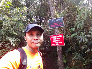
Notes : Simpang Y is a junction leading to 2 location,
Gunung kecil Hantu and Gunung Besar Hantu.
Gunung Kecil Hantu was closed due to landslide. We can’t
make it on that day.
We continued to Gunung Besar Hantu (on the right)
From Simpang Y to Summit
Distance : 500 meter
Time Taken : 30 – 40 minutes
Trail Difficulty : Hard and long incline!
Trail condition : Dry trail
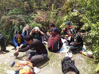
This is Cik Assila a.k.a "Luruh", one of the leader
En Faris (stirring the fried chicken) another leader for this team
Nice view of valleys and mountains here (if you were lucky).
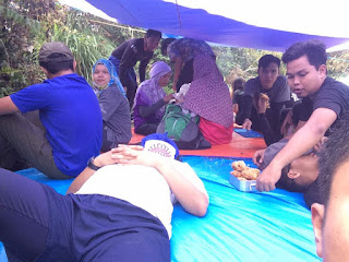
The team, lead by Faris, luruh and their team member are
performing a tremendous effort ensuring the safety, motivation, esteem and not
to forget, preparing a nice meal set consisting of fried chicken, nuggets and
sausages. We thank you for their relentless responsibilities.
Ascending down become easier as the trails are 95% downhill
and less effort of using energy (or what left). We reached the trail head
within 2 hours. Another 18 minutes (1.32km) to guard entrance. Another 2 km
reaching Kampung Orang Asli through rubber tree plantation before hitch a ride
to Kem Bukit Perjuangan, 12km away. We offered our rider a sum of cash for
their valuable service.
We ended the journey and back at Kem Bukit Perjuangan nearly
6.00pm, before heading home.


Assalamualaikum.....can share GPX file?
ReplyDeleteThank you..
wkumsalam. bagi saya email addres, saya akan email
DeleteSalam boss. Boleh minta GPx file? Email ke yusof_azhar@yahoo.com
ReplyDeletesorry for late reply, gpx sent
Delete