Introduction
Gunung Rajah
situated in the state of Pahang with the height of 1685 meter. It can be
climbed via two entrances, no. 1 – via Kuala Kubu Bharu, Kampung Pertak and
another, via Chamang Waterfall, bentong, Pahang.
Via Kuala
Kubu Bharu is much more shorter i.e 23km while from Chamang is 26.8km. You may
locate my previous post Gunung Rajah via KKB here.
I’ve been at
Gunung Rajah via Chamang years ago but due to my phone got lost in the jungle,
there were no photos, no record….but memories remain.
How to get
there
You may
search for Air Terjun Chamang or Chamang Waterfall.
GPS Coordinate : 3.509563, 101.857920
Accommodation
Cheap hotel
are aplenty with affordable at town area, 8km from chamang waterfall
Transport
It is
advisable to arrange for your own transport, public transport such as taxi is
another great way to get here.
The Starting
Point
There is
ample parking space at the waterfall equipped with toilet/shower. The entrance
is somewhere at the pondok.
There are few
check points you need to pass through, lets go one by one starting from the car
parking area :


The spot marked with "B" sign is the entrance. Credit to owner of this photo from google image.
Climb up. around less than 100 meters

You will reach here. 4 x 4 road. follow the signboard. 25km is the return journey

The dirt road

The big giant arch

Still at big signboard area. almost 4 km to here from parking
1) From Car
Park to Gunung Rajah big Signboard arch
This is the
large arch located at the foothill.
Distance
from start to here : 3.9km
Trail
difficulty : easy
Trail
condition : dry, dirt, 4 x 4 trail
Duration
Taken : 55 minutes (7am – 7.55am)


2) From
Signboard to Sungai Terling
Distance
from Start : 5.36km
Distance
from Signboard to Sungai Terling : 1.2km
Trail
difficulty : easy
Trail
condition : jungle trail, minor inclination
Duration
taken : 12 minutes (8.12am)


few hundred meters from the giant signboard - an open space

5.3km to here

Follow the right trail

Looking for the green arrow - top right
3) From
Sungai Terling to Resam
Distance
from Start : 7.29km
Distance
from Sungai Terling to Resam : 1.9km
Trail
difficulty : easy
Trail
Condition : dry
Duration
taken from Sungai Terling : 25 minutes (8.37am)


Looking for another green arrow - top left
4) From
Resam to Kuala Sungai Terling or “River Y”
Distance
from Start : 8.34km
Distance
from Resam to Kuala Sungai Terling : 1km
Trail
difficulty : easy
Trail
Condition : dry
Duration
taken from Resam : 20 minutes (8.56am)


This is River Y or Kuala Sungai Terling
The photo taken after we climbed down.
pay attention to the blue plastic tied on the tree - that is the trail marker

Cross this river to the other side. There is a directional arrow

surrounding area

Look for this signboard at River Y
5) From
Kuala Sungai Terling to Lata Naning
Distance
from Start : 9.59km
Distance
from Kuala Sungai Terling to Lata Naning : 1.25km
Trail
difficulty : easy, minor inclination, countless river crossings
Trail
Condition : dry
Duration
taken from Kuala Sungai Terling : 30 minutes
(9.29am)

almost 10km here. manageable track, few inclination but easy


The popular Lata Naning with its transparent water
6) From Lata
Naning to Kem Batu Hijau
Distance
from Start : 11.1km
Distance
from Lata Naning to Kem Batu Hijau : 1.5km
Trail
difficulty : Hard inclination, be patient
Trail
Condition : dry, river crossing, watch out for tree roots where you steps
Duration
taken from Lata Naning : 1 hour (10.26am)


7) From Kem
Batu Hijau to Permatang Guntong
Distance
from Start : 12.45km
Distance
from Kem Batu Hijau to Pematang Guntong : 1.3km
Trail
difficulty : hard inclination
Trail
Condition : dry
Duration
taken from Kem Batu Hijau : 1 hour (11.27am)


8) From Permatang
Guntong to Rock Climbing
Distance
from Start : 12.87km
Distance
from Permatang Guntong to Rock Climbing : 420 meter
Trail
difficulty : hard inclination
Trail
Condition : dry
Duration
taken from Permatang Guntong : 23 minutes (11.50am)


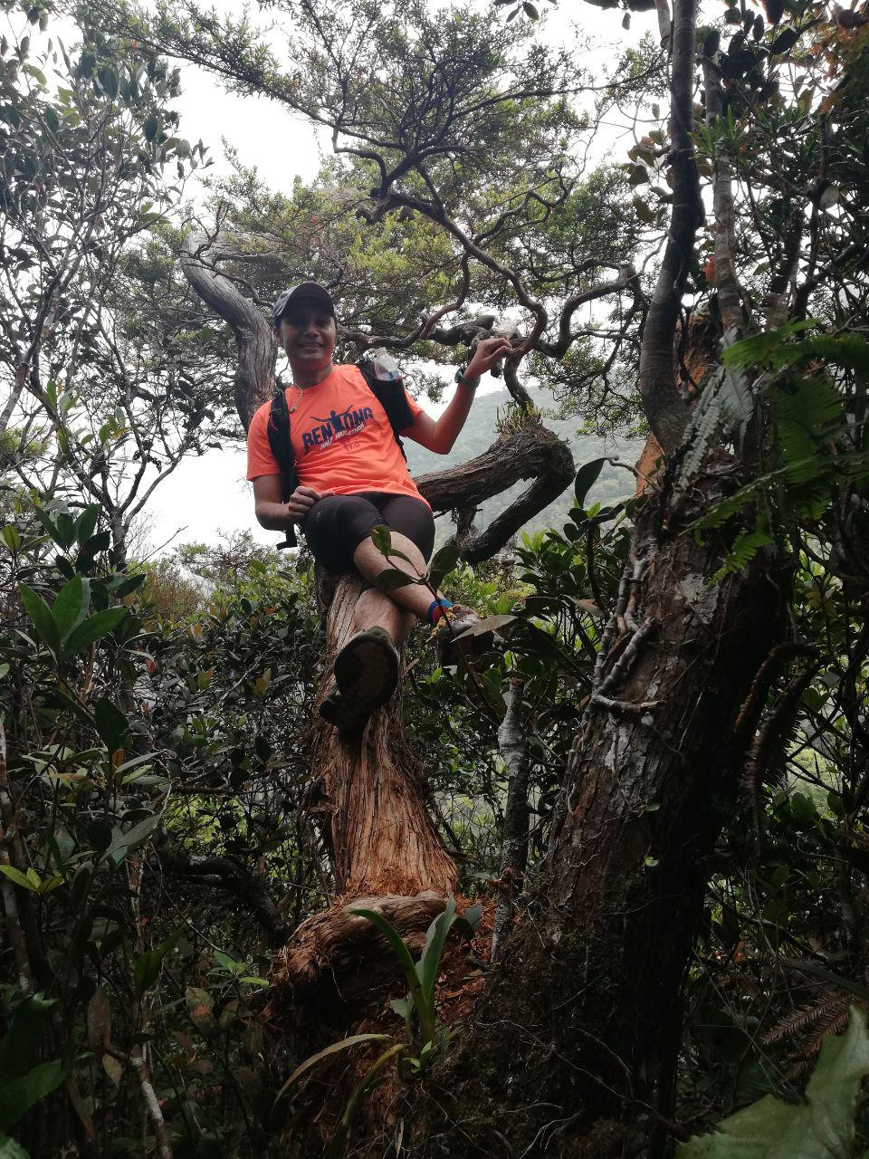

The infamous rock climbing


9) From Rock
Climbing to Last Water Point
Distance
from Start : 13km
Distance
from Permatang Guntong to Last Water point : 130 meter
Trail
difficulty : hard inclination, rock climbing in action, please be careful!
Trail
Condition : dry
Duration
taken from Rock Climbing : 20 minutes (12.09pm)


10) Final Push
!! From Last Water Point to Peak
Distance
from start : 13.38km
Distance to
Last Water Point to Peak : 380 meter only
Trail
Difficulty : hard inclination
Trail
Condition : soft, black plus half dried mud at certain point.
Duration
taken from Last Water Point : 30 minutes (12.38 pm)
Total ascending
: 13.38km in 5 hours 36 minutes


13.38km in 5 hours 36 minutes. Rested about 20 minutes here.
We moved
from Gunung Rajah peak at 1.00pm. Descending can be quite fast.
1) Peak to
Last Water Point – 16 minutes (1.16pm)
2) Last
water point to Rock Climbing – forgot to record..dem!
3) Last
Water point to Permatang Guntong – 43 minutes (1.43pm)
4) Permatang
Guntong to Kem Batu Hijau – 24 minutes (2.07pm)
5) Kem Batu
Hijau to Lata Naning – 28 minutes (2.35pm)
6) Lata
Naning to Kuala Sungai Terling (River Y) – 24 minutes (2.59pm)
7) Kuala
Sugai Terling to Resam – 17 minutes (3.18pm)
8) Kuala Sungai
Terling to Sungai Terling – 22 minutes (3.40pm)
9) Sungai
Terling to Signboard – 17 minutes (3.57pm)
10)
Signboard to Parking – 1 hour (4.56pm)
Total Descending
Duration – 4 hours


Ended in 26.8km in total journey almost 10 hours
There you
have it, the technical info about the distance, trail difficulty and time taken
for each check points. Hoping the above information could be useful for future
hikers to measure and plan ahead.
Food and
Water Ration
Being an
avid hikers and trail runner, I’ve been trained to consumed less drinking water
while my body adapt with such strenuous activity and pressure. I took 2.5
litres of drinking water, in 500 ml bottles (With one bottle refilled on the
way back).
Food – one Roti
canai telur, yes, that’s it!
In conclusion :
1) 10km from start is mostly flat
2) 3 km towards the peak is the most challenging with hard climb
3) There is no leech here
4) Water points are aplenty
5) You can cut almost 1 to 1.5 hours on the way back
Have a great weekend.
In conclusion :
1) 10km from start is mostly flat
2) 3 km towards the peak is the most challenging with hard climb
3) There is no leech here
4) Water points are aplenty
5) You can cut almost 1 to 1.5 hours on the way back
Have a great weekend.