The mountain's peak borders Pahang, Negeri Sembilan and Selangor.
There are 3 hiking routes to the peak - Kuala Pangson in Hulu Langat, Kampung Kemensah in Gombak and Bukit Tinggi in Bentong, Pahang.
As normal hikers can be, our journey will start from Pangsoon, Hulu Langat.
First thing first, pack light, start early, bring your food and prepare to torture yourself.

The travelling from highway exit to here is about 30 to 40 minutes or so. Once you reach this signboard, its another less than 2 km. Just go straight till the end.

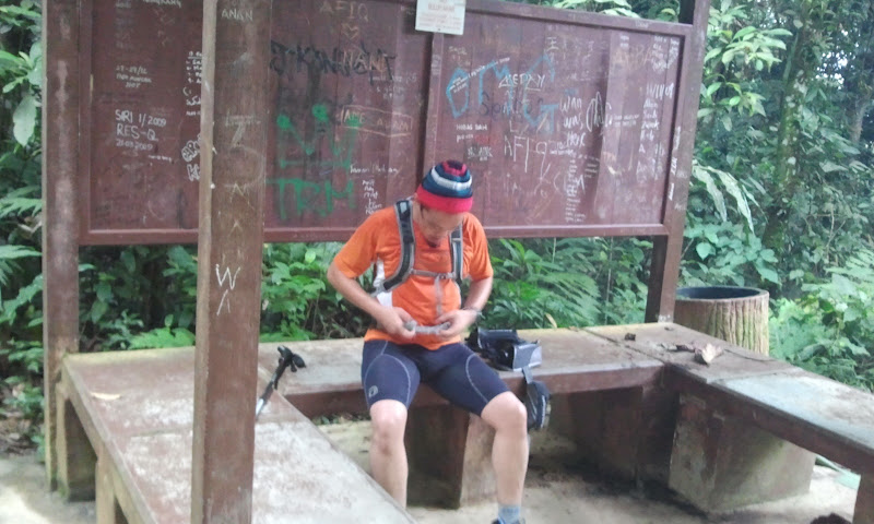
Zaki and Deo is having a light moment before the adventure

The Registration Section
You need to register your name, Date in, Date out, contact number, IC number, Home address and your signature onto this log book. Its a procedure we have to follow

Zaki is lefthanded

It's just RM1-00 per entry

"Well, you know me, I love adventure"

At the entrance's gate

We gonna rock Nuang!

Whatever...
Few things need to be remembered :
Your hydration - at least 2 litres
Your food - Rice, bread, chocolate, energy bar
Your Gear : backpack, hiking shoes, drifit attire, glove, hiking stick
Your first aid kit - band aid is sufficient
The caution :
Believe me you will fall, at least twice - so be extra careful, the terrain is slippery, with tree roots and full of holes. Especially when you're tired, you may susceptible to lose balance.
It's gonna be a very long hike, walk, climb - you need plenty of rest, make a lot of pit stops.
The stretch to the summit is appx 10km - 3.5 to 4.5 hours. And descending will tak appx 3 to 3.5 hours

stern warning sign

We're in!

The map
You may bump to this map, look easy.
First Stage : long up and down hilly terrain - peace of cake. 1 to 2 hours. Save your energy here.

Let's begin..!

It's getting tougher ..but manageable...
Both of Deo and Zaki is preparing for 'The Most Beautiful Thing' in Sabah, a 100km trail run (like we're doing right now) with a cut-off time of 30 hours schedule in 16th September 2012.

This is our attire...well zaki's is like hiking everest...

Hey..it's me...oblivious of what will come next
Zaki is suffering from high altitude sickness - his emitting gas!

At one of the rest area : from start point 4.1km to Lolo Camp 1.7km to go.

It's getting nearer

long way ahead

short breather - drink a lot of water ya..

Rest is over. Move on..

We have reached the end of easy part - end of stage 1.
This is the end of leisure hikers. You can enjoy the cool stream below. And turn back to the starting point.

This is the stream. Nice and cold. Tempting, but no...

Another breather for photoshoot session, we dont know when will be coming here again, maybe next year or so.

Deo is having a light moment
The second Stage - All the way up to Camp Lolo.
Estimated time of Arrival - 1 - 2 hours


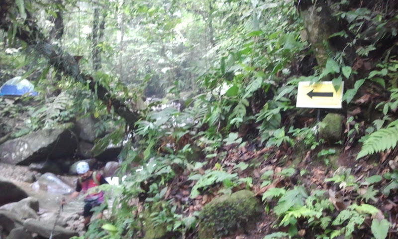
The arrow sign located here, near the pipeline and so as other confusing trail.

More photos of this confusing section...just watchout here.

Yeah..i'm not going to get lost...wohoo!

Walking few hundred metres, we will reach here...pipeline all the way up

On your right : The waterfall of death...this is the bottom

Another photo of the waterfall

"Whatcha doing up there/" - view from the top of the stairs

The stairs lead us to here. The dam.

The surrounding area at the small dam. A shallow stream

Some sort of water reservoir.

All the way down. The waterfall that I mentioned earlier

River crossing by Zack - this is how you do it without getting your shoes wet...yeah right

There are 2 (or 3) arrow directional signboards on the way up. They put it prominently to avoid confusion among the hikers. Maybe because there were people get lost before.

Other hikers on the prawl...dont worry of being left alone, there will always other hikers around

I think it's camp lolo. This is the camping site
More photo of the surrounding here

We got campers here

The small water fall - this is the spot we will enjoy our nice naked bath on the way back

I think this is camp lolo too...few hundred metres, we will reach here. It has quite a big shack for function or something.

This is the way up, the amoi behind Mr Deo is walking towards the correct path. Dont have arrow sign here, so, you might take note of this one.

Still at camp lolo...having a short breather, relax, rejuvenate, refill

Starting to feel unconfortable
End of Stage 2...
Stage 3 - to Camp Pacat
Estimated time of Arrival : 2 hours

The terrain - huff and puff!

This is green

Mushroom for soup

A breather again...

We're here...this signboard signifies our achievement. Let's 'Gangnam style'!

The open area at Kem Pacat

Proof that i've been here - En Zack

More photo of surrounding

The camping site at Kem Pacat
Stage 4 : All the way up to summit
Estimated time of arrival : 2 hours

At one of the section - soil erosion

"hey, I found a betel leaf"

"no, it's not"

"I've managed to take down this tree with my bare hand"

Your short break is essential for a recovery

The mist is coming. The wild banana tree is in the background

Zaki : "I can hardly move on with this tree in front of us"
Me : "maybe if the tree wasnt here, we can move easier and It will help other climbers too"

Zaki : "let us try to push this tree a little bit..hhhrrggh"
Me : "I'm too tired, I just use one arm to push"..mmmmphh!"

Zaki : "this is waste of time, we can't move this log, I told u to use both of your arm"
Me : "jangan merajuk zack, next time we will push another"

Zack : "try to bring this tree down ijam"
The mist is getting thicker by the minute

Sitting on the job training

My attire blends with the surrounding

This fallen tree had blocked the path. The new path was slippery like hell

Photo shoot is a diversion from the fatigue

The blurry image from top

Narrow path leading up

This old laminated sign of nuang summit is a god send.

Deo : "is my chin looks ok?"
This directional sign need to be adhered to because of the confusing trail. from this point to Nuang Summit, need another less than 1 hour.
Stage 5 : To the summit we go! The terrain upon us was no mercy. There will be up and down hill on the way up. We have to use our four core muscle to pull ourselves.

The steep section

Have a break

When I said 4 core muscle, I mean it! - Zack in action

After the Nuang Summit's signboard, we come to this puncak pengasih sign. Whatever that mean, we need to take photo.
Finally, we're here!!
In 4 hours 30 minutes ! After tortures hike, multiple fall and countless cursing (zack) and 2 failed attempt to return back, we made it!!

The climax is here - Sign of relief and satisfaction

Honey...I'm here, honest!

Proud and loving it!

where is that creature..?

oh..there you are...I'm frustrated for not allowed to feed the monkey in the zoo, so here I am, feeding the squirrel. Take that !

Crazy due to high altitude syndrome

Honey, I'm feeding this animal at nuang, not in the zoo, honest!!

Being lonely at the top


The mountain

more mountain

We rested about 50 minutes, and at 1.00 pm, we headed down..

This unique tree is at camp pacat. We kind of miss it initially.

Nice post by Mr Zack...a cool dip should do the trick

Satisfaction guaranteed - thumbs up for Gunung Nuang

Embassador for Salomon's sport apparel from top to toe
I need to rush back home, leaving the 2 guys on their own. My 'fast pace' descending from Nuang summit was the most gruesome and quite extreme. Managed to clock 2 hours 17 minutes. Wohoo!!