Its been a while since the last time I climbed Gunung Nuang via Janda Baik and I never put it in writing before.
Gunung Nuang have 2 entrances - via Pangsun in Hulu Langat and via Janda Baik, Bentong Pahang.
The trail from Pangsun is longer and psychology challenged but from Janda baik, it is more nearer - 6.45km one way.
Estimated Duration of Hike
Average hikers may reach the top within 3 hours to 4 hours and descending back to parking lot around 2 hours to 3 hours later.
Overall Track
Trails are clear, wide and have only one direction. Easy to navigate through even if you are a beginner.
Summary Of Hike
Total distance - 12.9km
6.45km one way
Trailhead Coordinate
3.303957, 101.887198
Breakfast and Lunch
Eating places and restaurant are aplenty along the way to the trailhead.
Parking
Last time we can park our car at the narrow road side but now the road side become narrower and being fenced, as such, the only car park in that area is at one of the land owner's. A designated parking area had been built to cater for the needs at RM5 per car. The area equipped with toilet and shower facility. If the car park is full, there is another parking lot at the side - also operated by the same land owner.
Since the parking lot is a fenced area, the problem arise if you arrive early before 6am (I think) because it is locked (I think...). So, please do take some consideration on your travel plan.
Road side parking (the blue car) and the fenced area parking lot - on the right
Toilet and shower facility
The Journey
The parking lot is the trailhead actually. You will need to cross the river.
Trailhead to The Steel Barrier (Through Vegetable Farm)
Distance - 790 meter
Time taken - 11 minutes
Trail condition - easy
The trailhead
The trailhead - This river located just in front of the parking lot. Impossible to miss it
Just cross over and head to the vegetable farm.
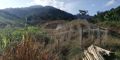
Vegetable farm like these are aplenty along the way
This is the steel barrier that once a ranger station. Just go straight following the gravel road.
Steel Barrier to Trail Junction
Last time the trail was different, I remember that I have to go into the woods soon after I cross the steel barrier, but now, we have to walk longer on the gravel road. Its long and slowly ascending.
Distance from Steel Barrier to Trail Junction - 1km
Distance from Start to Trail Junction- 1.78km
Trail difficulty - moderate ascending
Just keep going
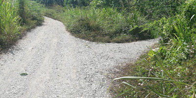
Please go straight when you reach this junction.
This junction will confuse you. straight, left or right
This is the junction trail head - with arrow sign on the photo
1.78 km from start, 26 minutes to reach here
This is where we came from - gravel road to dirt road.
If you have 4 wheel drive, you may park here
The dirt road continuation. According to the locals, this road is one big circle.
Trail Junction to Chemperoh Water Fall
Distance from Trail Junction - 1.5km
Distance from Start - 3.31km
Time Taken from Trail Junction - 30 minutes
Time taken from Start - 53 minutes
Trail Condition - moderate easy, ascending
Chemperoh Waterfall
Chemperoh water fall is at another side - little bit further
Chemperoh Water Fall to Simpang Bukit Repin
Distance From Chemperoh water fall to Simpang Bukit Repin -2.3km
Distance from Start - 5.64km
Duration taken from Chemperoh Water Fall to Simpang Bukit Repin - 1 hr 25 min
Duration taken from start - 2 hours 10 min
Trail condition - dry
Trail difficulty - hard!
Simpang Bukit Repin,
Simpang Bukit Repin to Nuang Peak
Distance from Simpang Bukit Repin to Nuang Peak -810 meter
Distance from Start - 6.45km
Duration taken from Simpang Bukit Repin to Nuang Peak - 32 minutes
Duration taken from start - 2 hours 43 min
Trail condition - dry
Trail difficulty - hard!
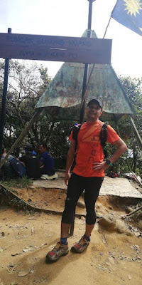
Made it to the peak
Rested around 10 minutes at the peak and headed down after that.
Estimated around 2 hours to descend down from Nuang Peak to parking lot.
Downhill all the way.
Thanks for reading.


