This is my 2nd time climbing Gunung Hitam but this time around, the climb was a bit treacherous and long (and muddy...and slippery).
You may find the previous post for Gunung Hitam here
Trans Langat involved hiking up and down to 4 peaks and walking or running on tarmac for about 11km back to starting point as you will start hike at Ikan Bakar Sri Nikat and end the hike at Genting Peras Signboard but since we parked our car at Ikan Bakar Sri Nikat....we have to walk/run back...huhu.
The 4 peaks are Gunung Hitam, Bukit Resam Ambat, Gunung Batu Resam and Bukit Batu Bulan.
Overall,Trans Langat may be completed around 15km in 6 hours 33 minutes if you end your journey at Genting Peras. Please add another 11km and almost 2 hours to Ikan Bakar Sri Nikat by foot.


Starting Point to Gunung Hitam Peak
Distance from Start to Gunung Hitam - 6.7km
Time taken - 2 hours 53 minutes
Trail condition - dry 70%, 30% soft ground
Trail difficulty : 3km hard inclination to the peak


Gua Jepun (Japanese Cave)
Don't really know where the name came from. Gua Jepun is located on our way to Bukit Resam Ambat, cannot miss this one. Distance from Gunung Hitam to Gua Jepun - 700 meters. It's just a huge "boulder-cave" like structure.

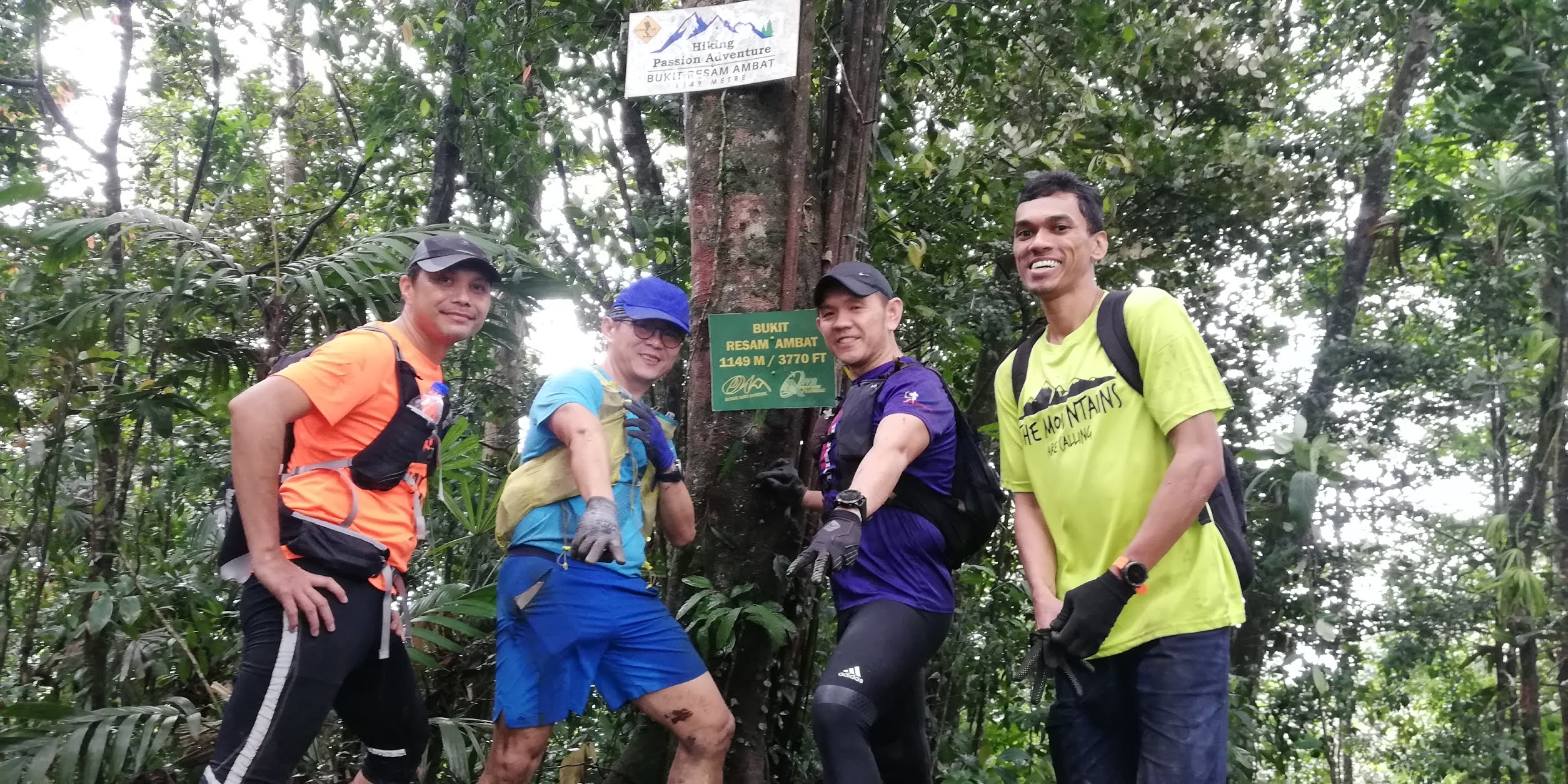
Gunung Hitam to Bukit Resam Ambat
Distance from Gunung Hitam to Bukit Resam Ambat - 2.2km
Distance from Start to Bukit Resam Ambat - 8.9km
Time Taken from Gunung Hitam to Bukit Resam Ambat - 1 hour 11 min (inclusive of resting for few minutes)
Time taken from Start to Bukit Resam Ambat - 4 hours 3 minutes
Trail Condition : muddy and slippery
Trail difficulty : moderate to hard inclination

Bukit Resam Ambat to Gunung Batu Resam
Distance from Bukit Resam Ambat to Gunung Batu Resam - 630 meters
Distance from start to Gunung Batu Resam - 9.5km
Time taken from Bukit Resam Ambat to Gunung Batu Resam - 20 minutes
Time taken from start to Gunung batu Resam - 4 hours 22 minutes
Trail Condition : muddy and slippery
Trail difficulty : More hard climb, brief slow ascending

Distance from Gunung Batu Resam to Bukit Batu Bulan - 2.2km
Distance from start to Bukit Batu Bulan - 11.7km
Time taken from Gunung Batu Resam to Bukit Batu Bulan -1 hour
Time taken from start to Bukit Batu Bulan - 5 hours 25 minutes
Trail Condition : muddy and slippery
Trail difficulty : moderate hard, slippery downhill

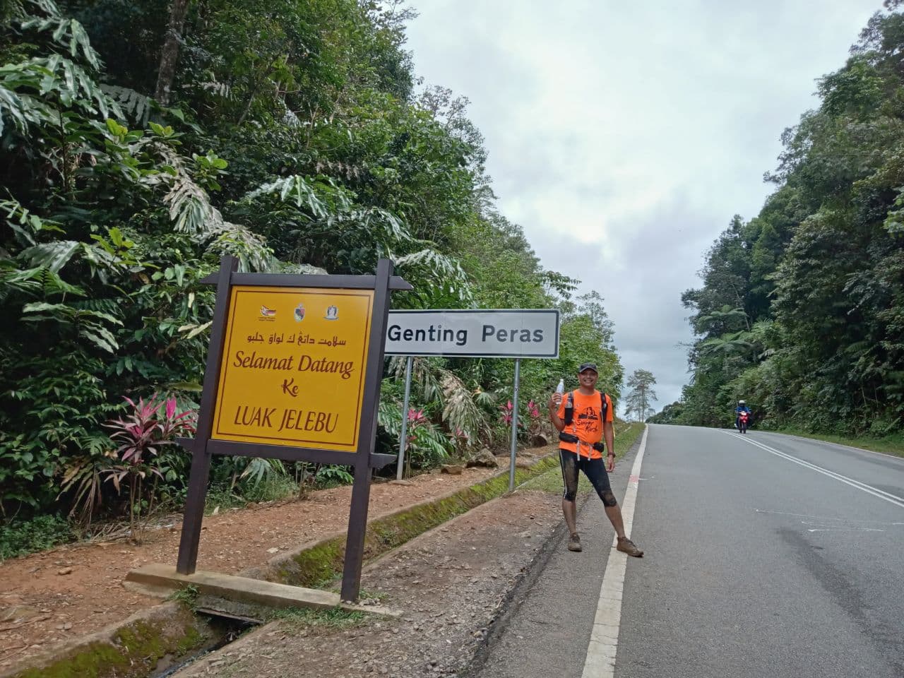
Bukit Batu Bulan to Main Road (Genting Peras)
Distance from Bukit Batu Bulan to Main Road - 3.3km
Distance from Start to Main Road - 15km
Time taken from Bukit Batu Bulan to Main Road - 1 hour 8 minutes
Time taken from start to Main Road - 6 hours 33 minutes
Trail Condition - extremely slippery, grab on to something on your way down
Trail difficulty - slippery making it hard, risk of falling down is high
Actually, your hike kind of ends here in Genting Peras as you are out from the forest. But since our car parked at Ikan Bakar Sri Nikat, here we go....running walking at noon and the heat was unbearable.


Distance from Genting Peras to Starting Point (ikan bakar sri nikat) - 11km
Distance from start to Starting Point - 27km
Time taken from Genting Peras to Starting Point - 1 hour 51 minutes
Time taken from Start to Starting Point - 8 hours 24 minutes
Road difficulty - easy, flat only, watch out for oncoming traffic
200 - 300 metres when we were out from the jungle, there's 4 x 4 trail road plus gravel road leading to main road known as Genting Peras (where the bikers/cyclist doing their rounds).
I would advise if you want to save that 11km walking back to starting point, and if you travel in a group, you may park one of your car here as a shuttle service back and forth.
Great hike and great company since we are under Control Movement Order (MCO) as travelling interstate is restricted.