Friday, March 16, 2018

Gunung Tok Nenek (Single)


Gunung Tok Nenek, standing 1914 meters, located in the state of Kelantan, Malaysia. 

Hiking Gunung Tok Nenek is normally combine with another 2 more mountains which are Gunung Yong Yap and Gunung Bubu also known as YYBTN (mount Yong Yap, mount Bubu and mount Tok Nenek). Most hikers will climb these 3 mountains at one shot with 3 days 2 nights on average duration.

(Pardon my english...its sucks!)

I attempted YYBTN in 2 days one night previously and this time, overnight in the cold and creepy jungle is out of my menu, our group will attempt to climb Gunung Tok Nenek only (most hikers call it Gunung Tok Nenek single) as fastest as we can. 

Most of the hikers will start from Sungai Regil (apart from 2 or 3 more entrances).

Measuring the distance from the start to the peak, it measured around 13.3km which is doable and somehow, realistic. We expect to reach the summit around 8 hours and descend back around 7 hours or so – 16 hours in total of estimation (on paper).

The entrance point from the mainroad to parking location is 5 km in distance which is the orang asli settlement

From masjid lojing - the entrance is on the right handside where the signboard, "hutan simpan kekal lojing"

GPS coordinate on the entrance at the mainroad : 
4.661062, 101.484326


We started around 6.30am with steady fast walk. Few river crossings along the way with 3 major rivers.

The car park

The new concrete bridge 


The old wooden bridge (just beside the new one)

From Start to Kem Simpang Y
Distance from Start : 5.28km
Time Taken         : 1.5 hours
Time of the day : 8.05am
Trail condition : dry, wet, river crossings
Trail difficulty : easy, a little bit of inclination,


The famous Simpang Y
Have to cross the river to get to this signboard.

When you reach Simpang Y, Mount Tok Nenek is on your left while Mount Yong Yap is straight ahead (crossing the river).


From Kem Simpang Y to Kem Lengkuas
Distance from Kem Simpang Y : 3.06km
Distance from start : 8.34km
Time of the day : 9.26am
Time taken : 1.11 hours
Trail condition :  wet - Countless River crossings, muddy
Trail difficulty : easy, becareful while crossing the river, bamboo phenomenon start here, have to duck, crawl 

 As I had accidentally reset my watch at Simpang Y. The distance appeared in my watch from now on will be based from Simpang Y (demmit!)

This is the correct measurement of distance from the starting point


From Kem Lengkuas to Kem Hari
Distance from Kem Lengkuas to Kem Hari : 2.27km
Distance from start : 10.6km
Time taken : 2.20 hours
Time of the day : 10.36am
Trail condition : dry and wet
Trail difficulty : moderate – bamboo all the way


From Kem Hari to Kem Belumut
Distance from Kem Hari to Kem Belumut : 2.4km
Distance from Start : 13km
Time taken : 1 hour 41 minutes
Time of the day : 12.12pm
Trail condition : muddy at certain part, dry at certain part
Trail difficulty : hard inclination


From Kem Belumut to Peak
Distance from Kem Belumut to Peak : 1.37km
Distance from Start : 14.37km
Time taken : 1 hour 45 minutes
Time of the day : 1.53pm
Duration from start : 7 hours
Trail condition : Dry
Trail difficulty : hard inclination


 Reached the peak at 1.21pm, 8.02km (from Simpang Y), 13.3km from Start

 Another watch indicated the distance from start to the peak is 14.37km...crazy!


We started to descend around 2pm. 
We reached Kem Hari within 1 hour 

 Reached Kem Lengkuas in 2 hours

We reached Simpang Y again within 3 hours. 

A snapshot at one of the orang asli hut 

 Finally there! few meters left

From Simpang Y to parking in 1 hour 30 minutes. 
We reached back to the starting point around 6.30pm after a grueling 12 hours.  Supposed to be 26.6km of journey.

In Summary:
Ascending : 7 hours, 13.3km
Descending : 5 hours, 13.3km
Total journey : 12 hours, 26.6km


One of many vegetable farm on top of the hill

Tips & Gear used :
1) Drinks - 2 litre...refill at the river. a lot of river crossing at the beginning of the journey.
2) Food - Ascending : Only stop for meal at kem belumut (bread, raisins), lunch at the summit (Nasi
                lemak)
              - Descending : bread at one of the stops, raisins, chocolate
3) Survival kit - first aid kit (plaster, panadol, hot cream), Lighter, extra batteries (4 triple As, 4 double As), Sawyer water filter tube, Power bank, usb light, pocket knife
4) Protection - glove, head light, battery powered small light
5) Others - small ground and fly sheet (fit for 1 or 2 person), rope, machete
6) Other recommended items : fire cracker (to stunned wild beast)


Friday, February 23, 2018

Gunung Datuk - Gunung Rembau - Gunung Gagak


Gunung Datuk standing 700 meters located in Jelebu, Negeri Sembilan. Gunung Datuk is too common for regular hikers and most of them will climb as part of their leisure hike during the weekend. Taking photo on top of the huge rock at the summit represent the graduation.

What is uncommon is that Gunung Datuk also has two more Gunung (mountains) i.e Gunung Rembau (884 meters) and Gunung Gagak (807 meters) which are adjacent to one another.
Arm with google information and analysis, we start our journey on early Sunday morning to conquer the 3 mountains at one go with total Kilometer of 9.6km.

Location of the road entrance leading to the parking area : Gps Coordinate : 2.534991, 102.163471 (junction from the main road).

The suunto movescount can be found here : Datuk

How the trail looks like from 'bird eye' view

Distance from Start to Peak : 2km
Trail Condition : Dry
Trail Difficulty : Moderate to Hard – Steep inclination
Estimated time taken : 1 hour 40 minutes

Distance from Start to Gunung Datuk summit : 2km in 1 hour 33 minutes

Just below the peak on top of Gunung Datuk. The stairs leading to Gunung Datuk summit is located on the left. The start trail to Gunung Rembau and Gunung Gagak is on the right. 

Gunung Datuk summit (the stairs) is on the right 

Distance from Datuk Peak to Simpang Y : 1.2km
Trail Condition : Dry
Trail Difficulty : easy
Estimated Time taken : 45 minutes
Distance from start : 3.2km

This is simpang Y. The tree with the blue plastic knot is the divider between Gunung Rembau on the left and Gunung Gagak on the right.

Distance from Simpang Y to Gunung Rembau  : 400 meter
Trail Condition  : dry
Trail Difficulty : easy
Estimated time Taken ; 10 – 15 minutes


Distance from start : 3.62km

Distance from Simpang Y to Gunung Gagak : 1.3km
Trail Condition  : Dry
Trail Difficulty : dry
Estimated time Taken : nearly 1 hour
Distance from Start : 5.26km
  
Gunung Gagak conquered!

Completed in 3 hours and 20 minutes -  5.26km from start

Overall
Total Journey : 9.6km
 Time Taken : 5 hours 8 minutes
Trail Difficulty : Moderate, hard at certain section


Ended around 5 hours with 9.6km journey.

Using the same trail to go back. Clear trail and plenty of trail marker. Can’t get lost here.
Thank you for reading.


Monday, February 19, 2018

Bukit Chenuang & Batu Kumbang, Hulu Langat, Selangor


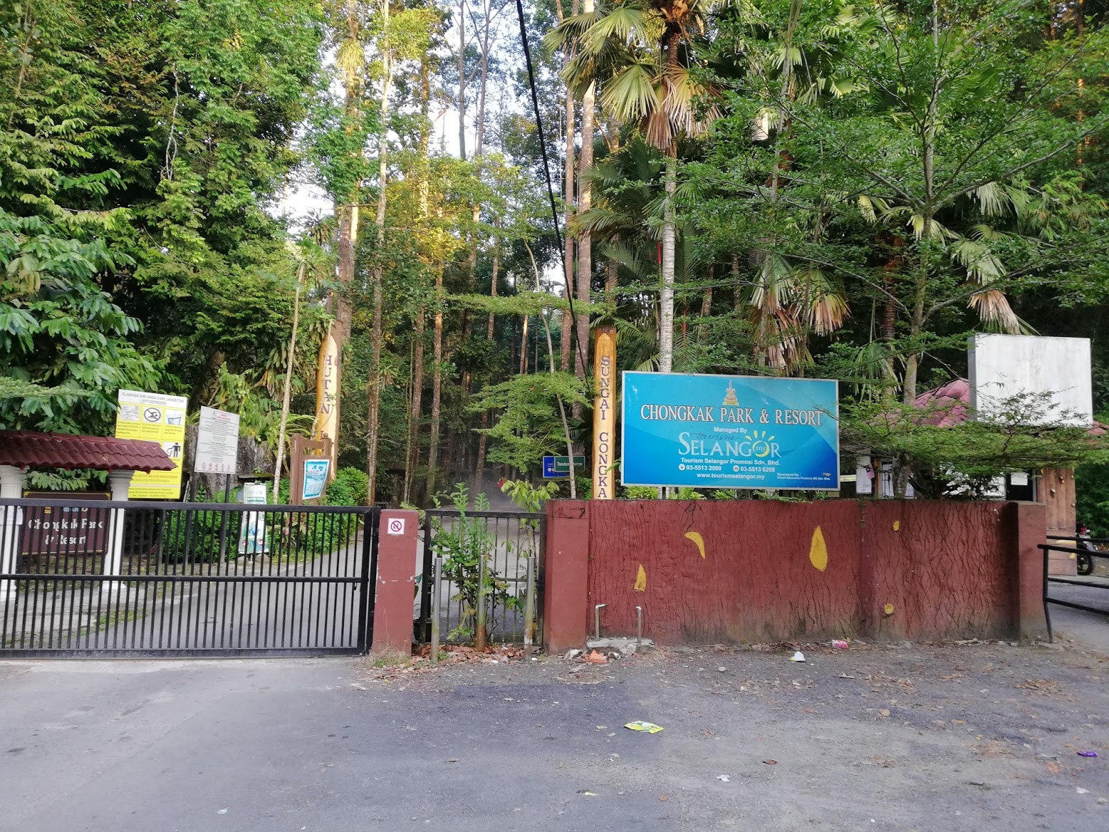
Bukit Chenuang standing 850 meters located in Hulu Langat and can be access via Sungai Congkak.
Our plan is first to climb Bukit Chenuang and  later to extend the journey to Batu Kumbang – further up and making a loop back to Sungai Congkak where we came from with total journey estimated around 13km or so. On the way back, we will be using different trail - through Orang Asli settlement (beware of dogs! – request the Orang Asli to accompany you walkthrough it).

Suunto Movescount route is here.


We started the journey through sungai Congkak entrance by foot, to the end of the road about 2km.
The entrance to Bukit Chenuang is on the left handside with red-white plastic trail marker.
The steep climb heading to Bukit Chenuang was expected and along the 2 km route to the peak, 80% will be a “climbathon”.


Met with a group of hikers at the middle – 4 or 5 of them, who recognized me with this blog…haha…didn’t realize that there are people out there reading it. There were 2 groups of hikers on that day – yes, it seems a popular spot for hikers.

Here’s a sneak peak on the technical part of the whole journey :

1st stage
Distance from Sg Congkak to Bukit Chenuang start trail – 2km (tarmac)
Time taken – 30 – 40 minutes

2nd Stage – Trail Head to Chenuang Peak
Distance from Bukit Cheuang trail to Chenuang Peak – 2km
Trail condition – Dry
Trail difficulty – hard, steep incline
Time taken – approximately 1.5 hours


3rd Stage – From Chenuang Peak to Batu Kumbang
Distance from Chenuang Peak to Batu Kumbang – 2km
Trail Condition – Dry
Trail Difficulty – hard, steep incline
Time taken – 1 hour 44 min
Leech or ‘Pacat’ – No


Stage 4 – Batu Kumbang to Sg Congkak
Distance from Batu Kumbang peak to Sg Congkak – 5 – 6km
Trail condition – Dry
Trail difficulty – easy, steep ascending! Becareful
Leech or “pacat” – Yes!


Route Navigation
Trail markers were aplenty along the route from the starting point to Bukit Chenuang and also to Batu Kumbang. But at certain section from Batu Kumbang back to starting point there were confusing/untraceable trail marker – you need to go left or right and look for the correct trail marker before you continue the journey.

The distance from Peak bukit Chenuang to this junction is appx 700 meters. Another 1 km to Batu Kumbang.

From Bukit Chenuang to Batu Kumbang, you will arrive at a junction, on your left is the way back to Sungai Congkak, and on your right is the trail to Batu Kumbang. You will climb Batu Kumbang then ascending down back to this junction again to go back.
You will know when you reach batu Kumbang, when there is a huge rock infront of you in the middle of the jungle. Turn on your left and look for the trail marker which will lead you to the top of the rock.

Reached Batu Kumbang almost 7km from start, 3.46 hours.

You will be rewarded with spectacular view of the valley! You won’t regret it. There are 2 viewpoints at Batu Kumbang, when you reach the 1st peak with that spectacular view, going further up, on your left is a trail down, and up again -  will lead you to the 2nd viewpoint. 40 second from the 1st viewpoint. Don’t forget ya.

On the way back to Sungai Congkak is the easiest part – descending and flat route all the way.

Total journey – 12.44km within 6 hours.

Done in 12.18km, few hundred meters to entrance of Sungai Congkak.


Monday, October 30, 2017

Gunung Kenderung & Kerunai Daypack- I beat the Sunrise!


Summary

Height
Gunung Kenderung standing 1220 meter and Gunung Kerunai - 1000 meter situated in Kampung Pahat, Gerik, Perak. 300km plus from Kuala Lumpur, a 4 hours journey.

Both mountains situated side by side and most hikers will conquer these 2 mountains at one go with 2 days and one night camping.

Distance:
The distances of both mountains are not much different, depending on which part you choose as a starting point.
Kerunai - from Simpang Y - almost 2km
Kerunai - from campsite - 3.8km
Kenderung from Simpang Y - 2.1km
Kenderung from Campsite - 1.8km
* the distances may have variances (plus minus)


illustration above is an estimation on the destination from relevant point


Duration of Hike:
Mount Kerunai - around 2 hours up, 1 hour descending
Mount Kenderung - around 3 - 4 hours up, 2 hours descending

Trail Difficulty :
Kerunai - Easy to moderate
Kenderung - Moderate to hard to Extreme

Permit from forestry department is needed for every purpose of hiking, so make sure to get approval beforehand. Permit is around RM13 per pax excluding administrative fees which is quite cheap.

Pick up Truck or 4 wheel vehicle Service is needed to bring you at the starting point, around 30 minutes journey. The cost per head is around RM25 to RM30 for return trip.

* for 4 x 4 service and Permit application please contact En Syaiful 0195233768

Accommodation:
Gerik town - plenty of cheap hotel. 20 minutes from Gerik town to Kampung Pahat.

Food : 
Gerik town - so many of them. please restock and refuel here

Entrance Fee;
Every hiker need to pay an entrance fee to the village community organizer at RM5 per person.

The Entrance Gate
The entrance gate is controlled by the village folks. It will closed at midnight and re-open for business around 5.00am daily. Pre-arrangement is needed, normally by the 4 x 4 operator.

The Step by Step;
After you obtain the permit and made arrangement with the 4 x 4 provider, you will rendezvous at the 4 x 4 house. There, the 4 x 4 will call the person who will check the permit and you may pay the entrance fee.

GPS coordinate Kampung Pahat :
Kampung Pahat Meet up point gps coordinate : 5.498048, 101.115539

Tips : 1) wear glove - for the rope, holding tree branches
          2) Bring 1 liter of water supply to kerunai (ultra light
              daypack)
          3) Bring 2 liter of water supply to Kenderung (you may refill
              at the campsite before hiking Kenderung
          4) Wear long sleeve and cap with flap to beat the heat on
               the way to Kenderung
          5) avoid bring unnecessary load - especially excessive
              drinks and food. You don't need that for less than
              2km distance

The Plan
We will hike Kerunai first as it is the easiest and hoping to catch the sunrise here. Then, hiking Kenderung with all our might and try to sustain the heat. Watching for sunrise from Kenderung is not possible as the journey may took longer and chances we might miss the sunrise in action is rather high.

The Hike
We decided to make this trip a daypack as based on estimation of the distance, it could be done within half a day. Our plan is to start around 5.00am to catch the sunrise at Kerunai, however, the whole process of waiting for the person in charge to open the gate and checking of permit, made us reached the campsite around 6.45am.

The journey via 4 x 4 from where we parked our car was around 30 minutes to the campsite.

The Map of Kerunai can be found here : Kerunai GPX File. Downloaded to my suunto ambit 2 wrist watch to assist in the navigation.

Reaching the campsite and we straight went to Simpang Y - almost 900 meters from the campsite.
There are 2 ways to Simpang Y,
- route no. 1 is, you may follow the 4 x 4 track which is 900 meters away OR
- you can use route no. 2, which is near the stream, where the water pipe is flowing which is much shorter route, 20 - 30 minutes - 400-500 meters :

This is the way to simpang Y. Just climb up following the water stream, then turn right

Another angle from the entrance to Simpang Y. The foreground is the campsite

This is Simpang Y
From the entrance from the campsite below, you will emerge from the way I pointed out.
On the right is the entrance to Kerunai
(This photo was taken on our way down from Kerunai)

After almost 30 minutes of hiking Kerunai, we reached at one point where we can view clearly the sun is rising with a sea of clouds covering the valley. The view was magnificent!


Done!

From Simpang Y to Kerunai Peak
Distance - around 2km (from Simpang y)
Distance from Campsite using 4 x 4 road - 3.88km
Duration - 2 hours from Campsite (ascending), 48 minutes descending to Simpang Y
Trail condition : dry
Trail difficulty - easy to moderate
Caution! : many black ants at the branches here, be careful on the trees

Reached Simpang Y from Peak of Kerunai in 47 minutes. Piece of cake 


 To Kenderung Peak is another 2.11km from Simpang Y

Back at the campsite. Go straight to the entrance of Kenderung

Another part of the campsite


Camp Solar - 780 meters from the Peak of Kenderung
Photo taken from our way down from the peak.
Took us 26 minutes to reach here.
There is telecommunication line here.

Can you spot me? This is the extreme part of the hike


Done! Kenderung Peak 

Distance from Simpang Y to Kenderung Peak  : 2.11km
Duration ascending: 4 hours (slept and rested at few sections..haha)
Trail condition : dry
Trail difficulty : moderate - Hard - Extreme
Duration descending : 1 hour 45 minutes
Caution! : Scorching hot! Technical climbing using rope. Falling rocks. Danger while descending
Tips : wear glove and let it slide while holding the rope, it will make your descending faster.

Safely reached the campsite at 3.42pm. Started descending from Kenderung peak around 2.30pm.

Summary of Hiking
Distance Kerunai and Kenderung - 11km
Duration overall - 8 hours 45 minutes

There is no telecommunication lines at the campsite. You need to walk a bit towards simpang Y to get that line (as indicated in my drawing above).

We got the news from other hikers who just came in that the 4 x 4 unable to reached the campsite due to slippery hill. So, we decided to walk towards simpang Y and make that call. Our driver was waiting for us just below Simpang Y to fetch us. Yay!

Based on the above walkthrough, readers would be able to arrange, estimate and properly plan their journey thus, making their safe journey in conquering both Kenderung and Kerunai.

Until me meet again.