
Gunung Pasir located at Sri Menanti, Negeri Sembilan standing 892 metres above sea level.
It is a rare mountain to climb as only a few (and brave like us) who dare to take up the challenge.
Searching via google there were less information about this mountain - the trail condition, difficulty and characteristics.
Since this is the second time attempting to conquer, we treat this hike as a revenge hike due to failure attempt a month ago.
Summary of hike
4.7km in 3 hours and 6 minutes (one way)
8.8km in 5 hours 17 minutes (return)
Trail condition - 100% dry.
Trail difficulty - Hard
(How hard? - 4km of hard inclination (98%)
2% or few hundreds metres are a brief downward and flat
Leeches - It was present and visible...hahaha...but not that many, few times I stopped and checked, there weren't any. But at one time, there were a few stuck at my socks
Mountain Characteristics :
- It's all hard inclination right from the start
- The chances of getting deviate off course are less compared to last time as we have set up more trail markers
- Be careful on what looks like a clear trail but lead to elsewhere
- Trail markers are aplenty but still you might end up looking for the correct trail path
- GPS navigation is a must (wikiloc on handphone, gps device, wrist watch gps) it will navigate through and alert if you gone off-course
- Without GPS navigation is also possible as the trails markers are sufficient to direct you to the peak but be extra alert on your next trail marker
- Thorny plants are thriving which can rip your shirt off or even scratch your pretty face until it bleed
- on the ground, there are creepy crawly plants that can tangle your feet and make you fall
- In case of lost, always retrace back your steps backward since you last saw the trail marker and check left or right for the next
- Somewhere few kilometres from the start is the last water point (just in case) but carrying with you a 1 or 2 litres of fluid should be sufficient

The GPS location via Google map
It will take you straight to our parking spot
Please enjoy parking area photos :

The road where we came from.
The parking is free and can park at the roadside.

Since this is a remote area, we thought of having our discussion at the middle of the road...haha


At the end of the road, there is a small bridge

A sturdy and strong bridge
Side track moment;
On early August 2020, me and 3 brave souls attempting to conquer Gunung Pasir. Mr Sega was the culprit to drag us along. Mr Chan being a supporter rarely refuse on such "rentis" (opening and clearing up trail).

This was at KM4 mark, where we decided to put a halt in our hiking (and tree chopping) as we were too tired plus I didn't prepare well enough (more plus...didn't bring my power bank...hahaha)
(Apparently on second time we were here, the trail ended here after we cut the tree branches...and the actual trail was on our right handside....very-very elusive)

Yes, I recorded the abandoned mission at 4th Kilometre...and 1.1km to the peak.

setting up trail marker for others

The spot where we celebrate our failure

At the beginning of the trail

Mr Chan with his parang that can cut the whole jungle in one day
OK, Back to current hike

after crossing the bridge, on your left, you will see some sort of agricultural activity going on

the agricultural thingy

Turning on your right is the trailhead


in we go
Here at 440 metres from the parking
be careful...though the clear path is straight, the actual trail is on the left with arrow sign.
the 440 metres sign

Another wrong turn...after we walk a little bit further, our navigation were off-course...so we retrace back and follow the correct trail.
There were many trail markers - just search for it and you will be fine

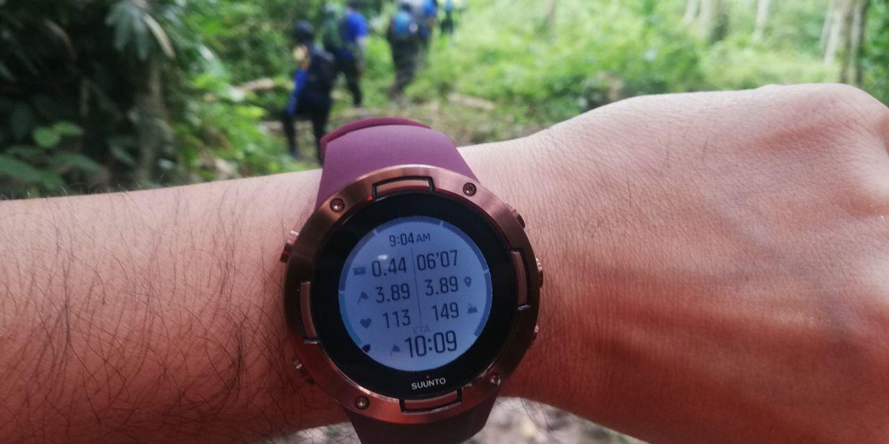
Just to show how suunto ambit 5 and its navigation point

The trail difficulty - you will have to endure a long and hard inclination mostly like this

only one section that you will go down for a brief moment
There were no resting point or camp, all it has are hills and more hills to climb
and finally after 3 hours of a grueling hike, we made it to the peak

1. Mr Chan
2. Mr Mike
3. Mr Daniel
4. Mr Sin (i hope no sin)
5. Mr Lew
6. Mr Sega
7. Mr Mikel
8. Mr Kenji
9. Mr Miguel
10. Mr Eddie
and number 11 is the tasteless wild Longan

The peak is a flat surface covered with fallen leaves.
The leeches are thriving here but not as many as Bukit Repin.
Still a few managed to bite but nothing to be alarmed (unless you're a leech-a-phobic)

After 4.7km and 3 hours 6 minutes later, we reached the peak of Gunung Pasir

Tips to maximize the length of your caution tape as trail marker...cut it into half.
You can cover more ground with trail marker

Mr Chan with his godzilla backpack that can bring the whole house fridge

Savouring the success at the peak
We descended down around 12.45pm

and reach the parking 1 hour 30 minutes later with 8.8km in 5 hours 17 minutes of total journey
Wikiloc gpx/fit map :


