
Gunung Hitam, located in Sungai Lui, Hulu Langat, Selangor with the height of 1220 meter and 5.83km distance (one way) from the car park (near the ikan bakar Sri Nikat pond restaurant) or 4.33km distance (one way) if start further up from Hutan Simpan Kekal Selangor parking area. Total journey of 11.46km in 5 hours 47 minutes.
50% of the trail is flat and the rest is hard climb.
Updated:
Download gpx route via wikiloc here






Descending

Getting There
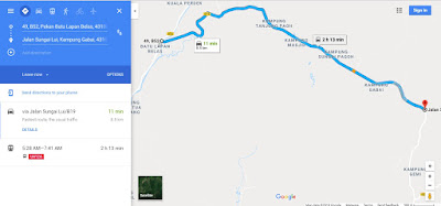
From Simpang Batu 18 to the main road junction – 8.3km
Distance from main road junction to Ikan bakar
pond – 350 meter

The distance from Pekan batu 18, Hulu Langat to the main road junction - 8.3km

This is pekan batu 18, Turn on your right to the bridge for a journey
of 8.3km

after 8.3km, you will reach to this main road junction. Please turn left

The Main road junction GPS Coordinate

After turning left, go straight another 350 meter to Ikan Bakar Sri Nikat

The GPS Coordinate for Ikan Bakar Sri Nikat
(the 1st car park or starting point). You can park your car here and start or you can
choose to park at 2nd car park.....please read on..

This is where we came from

This is the car park. on the background is the Ikan Bakar Sri Nikat
and the pond. Entrance to Gunung Hitam will be following the small road on the left.
You can walk or you can drive through this small road to the 2nd car park.

This is the Ikan Bakar Sri Nikat

This is the view from the road leads to Gunung Hitam

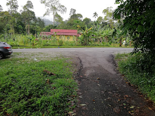
This is where we came from, the entrance to gunung Hitam is on the left junction

From Ikan Bakar Nikat junction, walking further up, you will reach this settlement

When you have walked or drove up to this point around 1.5km (from Ikan Bakar),
You will reach this 2nd car park with "Hutan Simpan Kekal" yellow signage.
on your left is actually the parking space

10 meters from the 2nd parking, you will reach this junction via the bridge.
There is a small stream below. Please go straight ahead

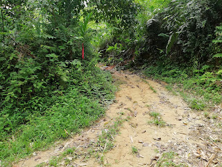
The beginning of the climb will start here. The red rope at the tree (if it's still there)

Suunto ambit 2 pre-install with Gunung Hitam GPX route
It's on track

Around 20 - 40 minutes, (cant remember actually...haha) we reach
at this hut...please turn left

Somewhere on the trail, you will see this sign

We saw this signage and thought we have reached the peak...haha...NOT!
The track is mean with endless inclination, so be prepared. I would estimate
the climbing part will be around 1km

Emergency Water Supply

Finally after 3 hours 42 minutes, we reached the top.
5.83km in distance at 12.23pm

Yup, this is gunung hitam peak


My personal glory photo at the peak. and yes, that's about it, there is no mountain valley
view, no fog, no wow....it's just a plain, normal, jungle peak condition.
Oh well, at least I've made it here.

Total Distance : 11.46km (till Ikan bakar nikat)
Climbing time : 3 hours 42 minutes
Ascending time : around 1 hour 40 minutes
Happy Climbing!

